Note
Go to the end to download the full example code.
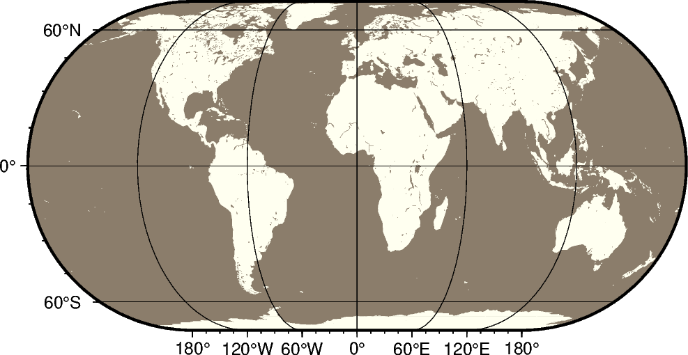
Eckert IV equal-area projection
The Eckert IV projection, presented by the German cartographer Max Eckert-Greiffendorff in 1906, is a pseudo-cylindrical equal-area projection. Central meridian and all parallels are straight lines; other meridians are equally spaced elliptical arcs. The scale is true along latitude 40°30’.
kf[lon0/]scale or Kf[lon0/]width
The projection is set with kf or Kf. The central meridian is set with the optional lon0, and the figure size is set with scale or width.
import pygmt

fig = pygmt.Figure()
# Use region "d" to specify global region (-180/180/-90/90)
fig.coast(region="d", projection="Kf12c", frame="afg", land="ivory", water="bisque4")
fig.show()
Total running time of the script: (0 minutes 0.227 seconds)